

Reimagining Toronto's Urban Highway
Amid worsening traffic, the city is committed to its highway infrastructure, envisioning unique public spaces beneath it as part of the solution.

Urban highways have played a prominent role in shaping the landscape of many cities, hailed as symbols of progress and connectivity.
In Toronto, the Gardiner Expressway, constructed from 1958 to 1966, exemplifies this trend, echoing similar developments in major cities like Seattle, San Francisco, Seoul, and Montreal that prioritized car-centric mobility and efficient industry throughout the mid-20th century.
The city’s waterfront has historically thrived as an industrial hub, with various factories and shipping facilities leveraging their proximity to water for transport - this offered practical economic benefits, fueling rapid urban growth and establishing transportation networks that efficiently connected suburbs to city centres. They also captured the spirit of modernity and freedom associated with cruising along expansive motorways.

The Gardiner Expressway Strategic Rehabilitation Plan
Recognizing the challenges posed by aging urban highways for rapidly growing populations, some cities have opted to tear down or repurpose them.
In contrast, Toronto has committed to a major rehabilitation of the Gardiner Expressway since 2016. After over 50 years of service, this core piece of the city’s transportation infrastructure has weathered progressive deterioration, necessitating extensive repairs. It currently handles approximately 140,000 vehicles daily.

Faced with mounting upkeep expenses and failed attempts to implement tolls, the city sought relief through a "New Deal" forged with the provincial government at the end of 2023, which will ensure the Expressway’s long-term existence. Due diligence will be conducted by end of this year to facilitate the transfer, including an assessment of rights-of-way, airspace, and underground ownership, along with legal and corridor management controls.
"By uploading the Gardiner and DVP (Don Valley Parkway), the city will be able to spend billions more on affordable housing, fixing transit, and building communities," Mayor Olivia Chow stated.
However, the deal comes with trade-offs. The city has agreed to relinquish some control over the province’s redevelopment plan for Ontario Place, a move that has sparked controversy, particularly regarding the proposed Therme spa on prime waterfront land originally intended for a public park.
And as the Ministry of Transportation will now have jurisdiction over the spaces surrounding the highways, concerns have arisen for Toronto’s autonomy in shaping its urban landscape and pursuing sustainability goals, particularly given the province's prioritization of car mobility.
Toronto's World-Leading Traffic
The rehabilitation project, currently in its second of six phases and coupled with increasing return-to-office mandates, has exacerbated Toronto's already notorious traffic congestion:
Worst congestion in North America: A recent report confirmed that the city has the worst traffic congestion in North America, trailing only behind London and Dublin in travel time.
Morning rush hour travel times increased by 250%: Commercial drivers are spending more time on the Gardiner, greatly impacting emissions and business productivity, with lengthy commutes costing an estimated $11 billion in lost productivity in 2022.
Public buses caught in the traffic jam: GO bus users are experiencing immense frustration, stuck in traffic for up to 45 minutes within walking distance of Union Station Bus Terminal.
Traffic will continue to slow down, below 20km: Based on the provincial government’s estimates, average driving speeds on local highways across the Greater Toronto Area are projected to drop below 20km/hr, even if new highways like Highway 413 are built.
While a $73 million stimulus funding in response aims to accelerate project completion by a full year, from April 2027 to April 2026, it remains to be seen if these efforts will alleviate the growing congestion and its cascading effects.
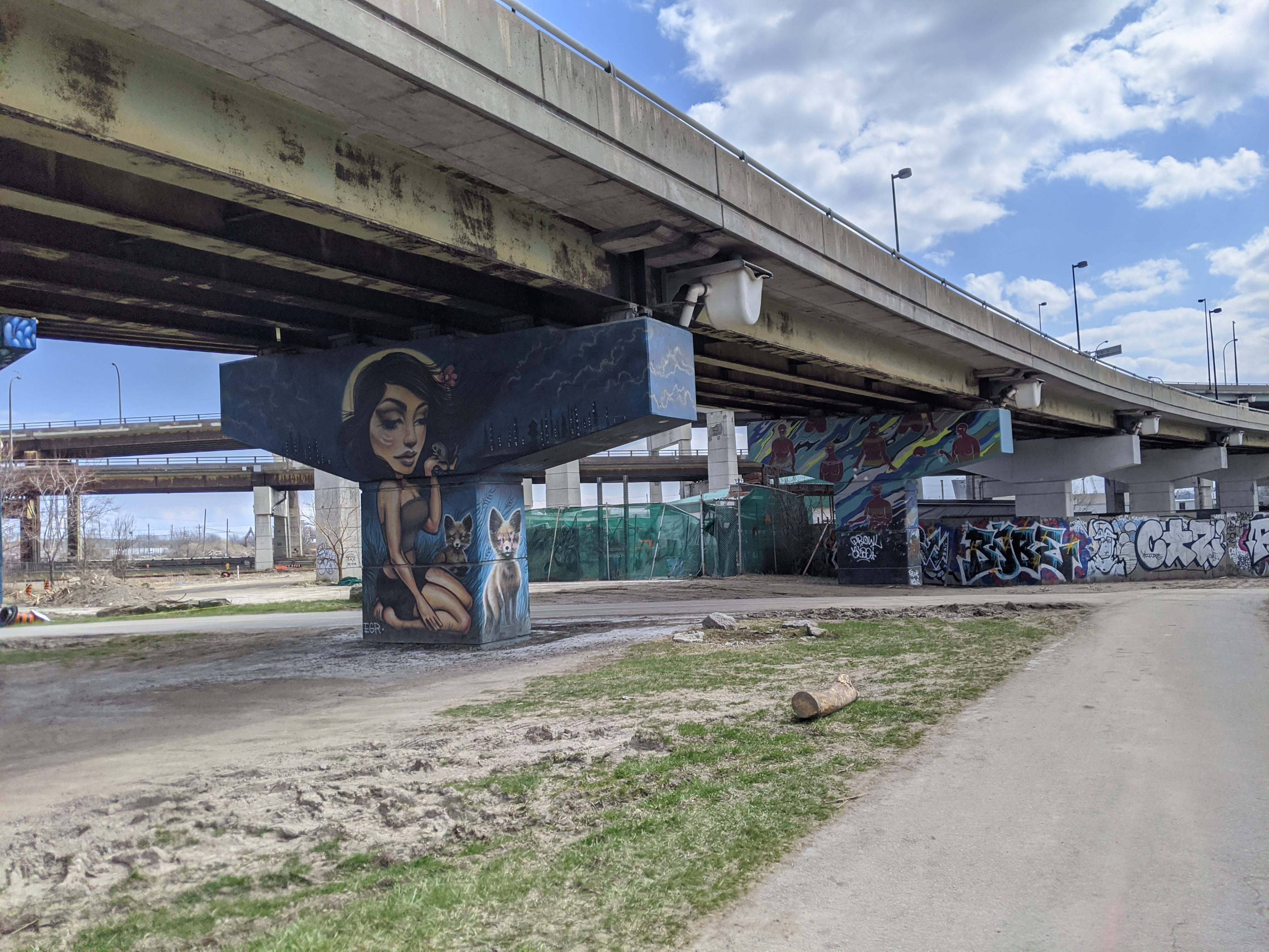
Creating a Public Realm Under the Highway
Acknowledging the complexity of urban mobility challenges, city planners are not only focusing on the expressway itself but are also turning their attention to the space beneath it.
Vehicles are also efficiently connected via Lakeshore Boulevard, yet increasing gridlock on this additional surface artery presents a unique and urgent opportunity. The underutilized space beneath the Gardiner can be transformed into inspiring community spaces, fostering a more connected and cohesive public realm.
The city’s official Under Gardiner Public Realm Plan envisions converting the 7-kilometre stretch beneath the elevated expressway into a vibrant, multimodal corridor that values pedestrian and cyclist safety, accessible amenities, cohesive identity, and productive natural components to offset the Gardiner’s increased emissions and environmental impact, while also improving air quality and reducing the urban heat island effect.

This ambitious revitalization aligns with the objectives of the "Shoreline Stitch", a broader city initiative striving to reconnect downtown Toronto to its waterfront by addressing the physical and psychological barriers created by rail lines, the Gardiner Expressway, and Lakeshore Boulevard. The waterfront itself is also undergoing a significant transformation.
Realizing the Under Gardiner Public Realm Plan will be a multi-decade endeavour, demanding collaboration and thoughtful planning to align with existing City plans like Vision Zero, Complete Streets, and the 2040 net-zero emissions target.
By encouraging alternative modes of transportation like walking and cycling, this project can help achieve manageable traffic levels for a densifying population, crucial for unlocking the potential of innovative, hybrid infrastructure that can distinguish the city.